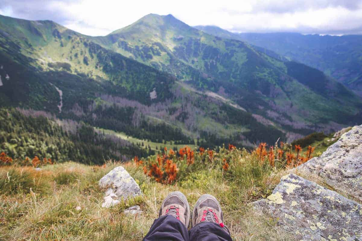

Searching for the best hiking destinations in the US? We got you covered with this list of some of the best hiking trails in the US! These wonderful hiking trips in the USA, also happen to be perfect for the Fall or for almost any season!
Fall can be the best time to go hiking in the USA. It is a good time of year weather-wise for taking to the hills, of course, the views in Fall can be stunning, and there’s nothing like breathing in the beautiful clean, crisp air! If you are interested, here are some of the most recommended hiking trails in the US for this coming Fall.

Outdoor & Hiking essentials we love!
#1 Essential when going hiking is having good hiking shoes. We loving this Columbia Women’s Waterproof Hiking Boot.


*Another great choice is this Moab 3 waterproof hiking boot.
#2 Essential when going hiking is having a good backpack. This is a really great Lightweight Packable Waterproof Travel Hiking Backpack.


Another must-have for hiking are trekking poles. These 2-pc Pack of Hiking/Walking Sticks are adjustable and crucial if hiking on rocky terrain or supporting heavier weight.


Keep yourself hydrated with this double-wall insulated water bottle which is cup holder friendly, road-trip approved, and adventure-ready!


I also love this TUMBLER of 40 OZ from Stanley. It is constructed of recycled stainless steel for sustainable sipping. The vacuum insulation is great because your water will stay ice-cold, hour after hour.
We personally love this outdoor performance shirt for hiking, it comes with long or short sleeves and it has 50+ sun protection. It is usually good to carry a waterproof rain jacket like this one too.


When hiking, it is a must to have a compact first aid kit in case of an emergency. We totally recommend this one, which has over 85 pieces.


This Swiss Army Camper Knife by Victorinox can save efforts in some of the trickiest hiking/camping scenarios. Don’t be fooled by its compact size; it has 13 features stacked within it!


These 100% Biodegradable Feminine Hygiene Outdoor Wipes are perfect for adventurous women! Give them a try!


Another great must-have for outdoor lovers is this easy to carry Outdoors Pocket Blanket by Momo Outdoors. It is packable, lightweight, compact, sand proof and waterproof. It is ideal for camping, hiking, picnics and even for the beach.


It is good to always have our devices charge, and we love this power bank which has 2 ports for fast charging.


Best Hiking Spots in the USA that are perfect in Autumn
Denali National Park, Alaska
Denali National Park may not be close to your home but it is so full of exquisite hiking opportunities that it’s worth traveling. Not sure if you know that Denali is the highest mountain peak in North America. Hikers can enjoy low-elevation taiga forest, high alpine tundra, and snowy mountains. Wild animals live here, as they have for ages, so be mindful. Hikers walk here through solitude, tranquility and wilderness.
Imagine adding to the breathtaking fall colors to this experience? Fall arrives in the area sometime between late August and early October. From a luxuriant green, much of the vegetation turns into a mix of dark amber, red, and orange hues.
Hikers can choose between Trail hiking and Off-trail hiking. The park offers many trails, just want to mention a few: The Horseshoe Lake Trail, the Jonesville Trail, the Meadow View Trail, the Morino Trail, the Forest Trail, the Taiga Trail, the Savage Alpine Tundra Loop, the Roadside Trail, among many others.
Note: Always be prepared and properly attired before you try any hike, but one of the most important things is choosing a quality hiking boot.
Recommended: A 7 day road trip itinerary for Alaska, including a stop at Denali National Park

Grand Canyon National Park, Arizona
Grand Canyon National Park, in America’s southwest, is a hiker’s paradise. There are two sides to approach Grand Canyon – from the less-visited – and higher – north rim, and the more popular – and more accessible – south rim. There are several hikes around and from the South Rim. The most famous is the Bright Angel Trail, down into the canyon.
The trail starts at Bright Angel Lodge and descends 10 miles down a series of steep switchbacks to the Colorado River far below. To do the full hike requires a stay at Phantom Ranch, which has a complicated booking process, or Bright Angel campground.
Other trails are the North Kaibab (to complete the rim-to-rim hike) or the South Kaibab, which takes you back up to the south rim. These three trails all require a reasonable level of fitness. If you want to hike below the rim and don’t want to go all the way, you can hike along the Bright Angel Trail for 3 miles to Indian Garden and then back up again in the same day.
An easier hike along the south rim is the Rim Trail, which stops off at several stunning viewpoints along the way. This trail is good for beginners.
The nearest main town to the south rim is Flagstaff, where there is a small regional airport with frequent connections from Phoenix and Las Vegas. At the South Rim/ Grand Canyon Village, there are several lodges and campsites, including an RV park.
If accommodations are all full, there are also several hotels, motels and campsites in Tusayan, about 7 miles away. There is also a lodge open in season at the north rim and a daily shuttle between the north and south rims.
Suggested by James Ian from Travel Collecting

Check out this post: The Best Day Trips from Phoenix, Arizona
Havasu Falls, Arizona
Hiking to Havasu Falls is one of the most beautiful and stunning hikes in the US. This hike is an intermediate hike and in some parts would even be classified as difficult.
In order to visit Havasu Falls, you must have a permit. Your permit is valid for three days. You will spend the first day hiking 10 miles into the campground. You will need to bring a tent and all of your own food for three days.
Your second day will be spent enjoying all five waterfalls in Havasu. Your third day will be spent hiking back out of the canyon which is 10 miles uphill.
Havasu Falls is one of the most waterfalls in Arizona and well worth organizing a trip and getting a permit. Permits open on February 1 every year for the rest of the year. Havasu Falls is closed in December and January.
As this location has become more and more popular, it has become more and more difficult to get a permit but there are groups where you can exchange dates so there is definitely hope!
To get to the trailhead you will need to take Highway 66 to Hualapai Hilltop and then start the trail there. There is a village about a mile from the campground if you want to pick up some basics.
Suggested by: Nicole from the blog American SW Obsessed
Sedona, Arizona
One of the best places to go hiking in the USA is the town of Sedona, located in the state of Arizona. Only about a two-hour drive from Phoenix, it’s possible to visit Sedona as a day trip, though spending at least a few days here is ideal to be able to explore it properly.
Sedona is full of a number of amazing hiking trails allowing you to explore the stunning red rock scenery as well as the vortexes in the area. One of the most popular trails is the Devil’s Bridge Trail, which is fairly flat for the majority of the trail though does get a bit steeper as you reach the final viewpoint. Overall the trail is fairly well marked and suitable for beginners.
If you’re after a more challenging hike then consider the West Fork Trail which contains over 13 river crossings! During the colder months, the trail can get very icy and slippery so make sure you have suitable footwear!
Apart from hiking, Sedona is also famous for the spiritual lifestyle of its residents so make sure to check out some of the new age shops in the main town. You can even get past life and tarot card readings in many of them. If you’re not a spiritual person, there are also plenty of great artisan shops to check out after you’ve tackled a hiking trail.
Finally, no trip to Sedona is complete without enjoying the sunset – one of the best viewpoints for this is the Airport Mesa Viewpoint which is easily accessible.
Suggested by: Michael from the blog The World Was Here First

King’s Canyon at The Sierra Nevadas in California
King’s Canyon tends to be the lesser-visited National Park that graces the Sierra Nevadas in California. But it’s a hidden gem that should be explored by outdoor enthusiasts who love impressive mountains and incredible hikes.
You can get to King’s Canyon from the nearest city of Fresno or Visalia, and a car recommended for transportation. The roads are windy – but the views are spectacular! Feel free to use the pull-offs along the way to snap some epic photos.
When you reach the end of Hwy 180, park your car and head out on Bubb’s Creek Trail that starts at the Rae Lakes Loop Trailhead. This hike is flat for the first couple of miles as it follows the valley and the creek with incredible views of the surrounding cliffs and mountains.
After about 1.5-2 miles, you have the option of starting the climb up to Mist Falls over 100 feet high. This steady uphill is worth the views of the valley and mountain tops. IIf you prefer a flatter hike, stay on Bubb’s Trail and continue past Bailey’s Bridge on an out and back hike that will give great views of the King’s Canyon.
On your way back down Hwy 180, stop at Roaring River Falls for a quick ¼ mile hike up to this impressive waterfall with a deep blue lake. After your hikes, you can relax back at your chosen accommodation of either Moraine, Canyon View, or Sentinel Campground which are all nearby. If you prefer a less primitive accommodation, Cedar Grove Lodge is another nearby option.
No matter where you stay, you will have an incredible experience at King’s Canyon.
Suggested by: Ashley from the blog Impact Winder

May Lake, Yosemite National Park, California
The two-and-a-half-mile Yosemite hike, a round trip to May Lake, takes 1.5 – 4 hours depending on experience and conditions. This is one of Yosemite’s most scenic lake hikes that’s especially gorgeous in the fall. May Lake is pretty and Mount Hofmann makes hiking even more attractive with the views of the wilderness.
Although short, the hike starts at a high elevation. The trail up the mountain is steep, sometimes covered with a decomposed granite which is very slippery, so you have to walk slowly and very carefully.
It is not an overcrowded hike, but you won’t usually be alone. There are so many amazing things to do in Yosemite.
Overall, Yosemite is a great place for backpackers and adventure lovers.

The Lizard’s Mouth Trail in Santa Barbara, California
Santa Barbara is one of the many beautiful cities that lay beside the Pacific Coast. Unlike its pricey neighbours-LA and San Francisco, Santa Barbara has lots of free things to do. One such activity is hiking the Lizard’s Mouth Trail, a large formation near the peak of the Santa Ynez Mountain.
Tucked away amid rolling hills and vast greenery, Lizard’s Mouth is a charming escape that overlooks the Pacific Ocean. Getting there isn’t difficult. From the Santa Barbara town center, drive down US-101 N and CA-154 W through hills and valleys. Once you arrive at West Camino Cielo, park your car on the side of the road beside a small path (there aren’t specified parking spaces on the mountain).
The path will lead you through a stretch of rocks with few branches and bushes. It’s an easy hike towards Lizard’s Mouth, but I’d recommend wearing some decent hiking shoes as you will encounter a rocky upward slope.
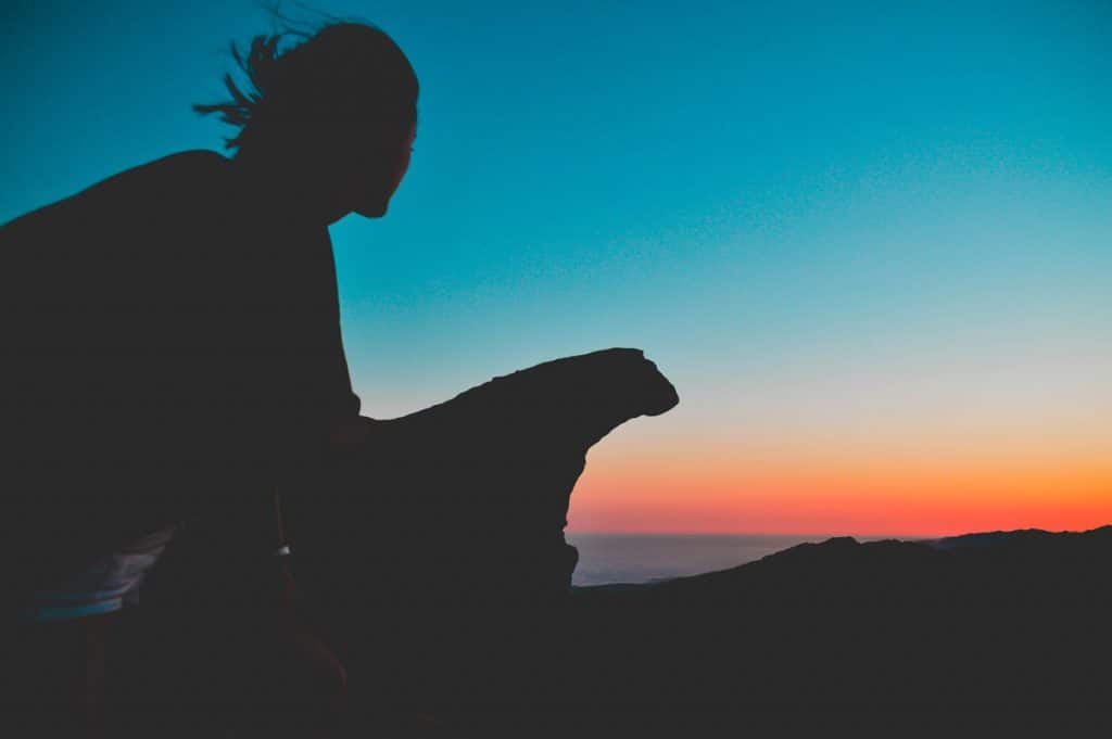
The minute we stepped out from the trail, I was absolutely mesmerized by the view. To the front, I could see the vast, crystal clear ocean that sat peacefully against the backdrop of bright blue skies. To the left, the city rested quietly beside the elevation. To the right, magnificent sunset colors wrapped around the undulating hills, fading into the gorgeous valley below. There weren’t any banisters or guardrails, which made tackling the viewpoint quite an adventurous undertaking!
Without a doubt, Lizard’s Mouth is one of the most breathtaking trails I’ve hiked in the US. Whether you decide to stay a night in Santa Barbara or otherwise, don’t miss the chance to see the city from above.
Suggested by: Daisy from the blog Beyond My Border
Eastern Sierras in California
The wilderness that covers northern Inyo County and Mono County provides some of the best hikes and sights in the fall. They include several must-go-to places including Bishop Creek, Convict Lake, and the Mammoth Lakes Trails.
With the Mammoth Lake trails, you will also find some that are particularly noted for the colors and views. These include the June Lake Loop, Rock Creek Lake Trail, and Heart Lake Trail.
You might also like: Why you need to visit Colorado

Rocky Mountain National Park in Colorado
The best time to enjoy the beautiful, famous Rocky Mountain Park views is to visit in early to mid-September. As well as the differences at various elevations, you might be lucky enough to catch a glimpse of the elk herds who live near Estes Park.
The park covers a vast area and is a popular tourist destination. With five visitor centers, you’ll find plenty of opportunities, especially helpful for those new to hiking or anyone who likes a group hike, to be part of organized treks.
Little lakes Valley Trail in Bishop, Colorado
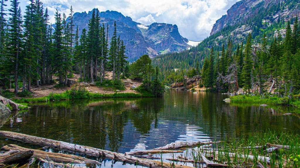
Compared to some hiking trails, this one is fairly flat. It is an alpine valley that is dotted with several lakes and breathtaking views of the surrounding mountains. It is a beautiful place to visit any time of year, and the drive to it is just as stunning.

Hiking to Alice Lake in the Sawtooth Mountains, Idaho
The Sawtooth Mountains of Idaho are a hidden gem when it comes to hiking and backpacking in the United States. Many people go to Colorado or California or even Wyoming to hike and explore, but the Sawtooth Mountain Range should equally be on your list of must-visit areas. A great way to experience the Sawtooth is by hiking or backpacking one of its many beautiful trails, and my favorite trail is the Alice Lake hike.
The 12-mile hike to Alice Lake is somewhat steep, but you’ll be rewarded with absolutely gorgeous views of Alice Lake as well as the surrounding mountains, which include Idaho’s version of “El Capitan”. These peaks of the Sawtooth Mountain Range are often referred to as the “Dragon’s Back,” since they look very similar to the ridges you would find on a dragon. The trail to Alice Lake is not technical so the elevation gain is the biggest challenge and it’s very doable as a long day hike.
If you want to take your time, however, I highly recommend doing the whole 19-mile Alice Toxaway Loop as a two to three day backpacking trip. This also gives you the option to camp out closer to Twin Lakes for some more solitude in the wilderness.
The Sawtooth Mountains are located an approximately 3-hour drive from Boise, which is home to the main airport in Idaho. The nearest town to Alice Lake is Stanley, and you should plan to head there after your hike for burgers, beer, and a relaxing dip in one of the nearby hot springs. You won’t regret your visit!
Suggested by Allison from She Dreams of Alpine

Miami Woods in Morton Grove, Illinois
Situated about an hour outside of Chicago, you will find this a perfect place for a hike. Although Chicago is known as a busy city, associated with tons of traffic, this gem is away from all of that hustle and bustle. As you walk in, the canopy of trees sparkle with brilliant Fall colors, and it is well worth putting your best boots for this occasion.
Some of the best trails can be found in Miami Woods, including the Trails of Terror, the River Trail Nature Center, Green Bay Trail, and The Grove.
Recommended: The perfect 3 days in Chicago written by a local
Jordan Pond Full Loop: Acadia National Park, Maine
The Jordan Pond loop is a great choice for an easier, more manageable hike, so It is suitable for different skill levels. It is 3.4 miles long and is a heavily trafficked loop trail. The path is best used from April until October, but is loveliest in the fall with wildflowers, and the trees turning orange and gold. The trail also offers a number of activity options.
Jordan Pond is Acadia’s deepest and cleanest lake. It is a public water supply, so swimming is not allowed, but beavers are often spotted there. It is a kid-friendly and pet friendly path; your dog is allowed to accompany you, but must be on a leash.

Blodgett Canyon to Waterfall hike, Hamilton, Montana
Blodgett Canyon to Waterfall trail near Hamilton, Montana is a moderately trafficked trail with a waterfall and views of outstanding cliffs and spires. It is 8.5 miles long, used for hiking and trail running, but also for nature trips.
The trail is well-maintained, with a mild elevation gain. Although open from May until October, its beauty in the fall is unspeakable. You can take your dog with you, but it must be kept on a leash.
Bisti Badlands, New Mexico
Bisti Badlands, in New Mexico, was considered one of the “Best Trips of the Year” by National Geographic in 2019 and I had the chance of joining a 6 miles hike with Navajo Tours USA.
Six miles seems a grain of sand when you think that there are approximately 60 square miles of remote badlands there. Since I joined an early morning hike, I drove from Taos to Farmington the day before and spent a night at the Courtyard By Marriott Hotel.
I recommend a guided hike because you can easily get lost since mobile phones don’t work really well. During the Bisti Badlands tour, you will see some rock formations called “hoodoos”, “egg hatchery”, the “arch”, among others.
Pro-tip: bring lots of water and snacks. As far as amenities, the Bisti Badlands parking lot now has a double-vault restroom and a canopy with picnic tables.
Suggested by Leticia from the blog Hospitality Vitae
The Historic Railroad Trail at Hoover Dam, Nevada
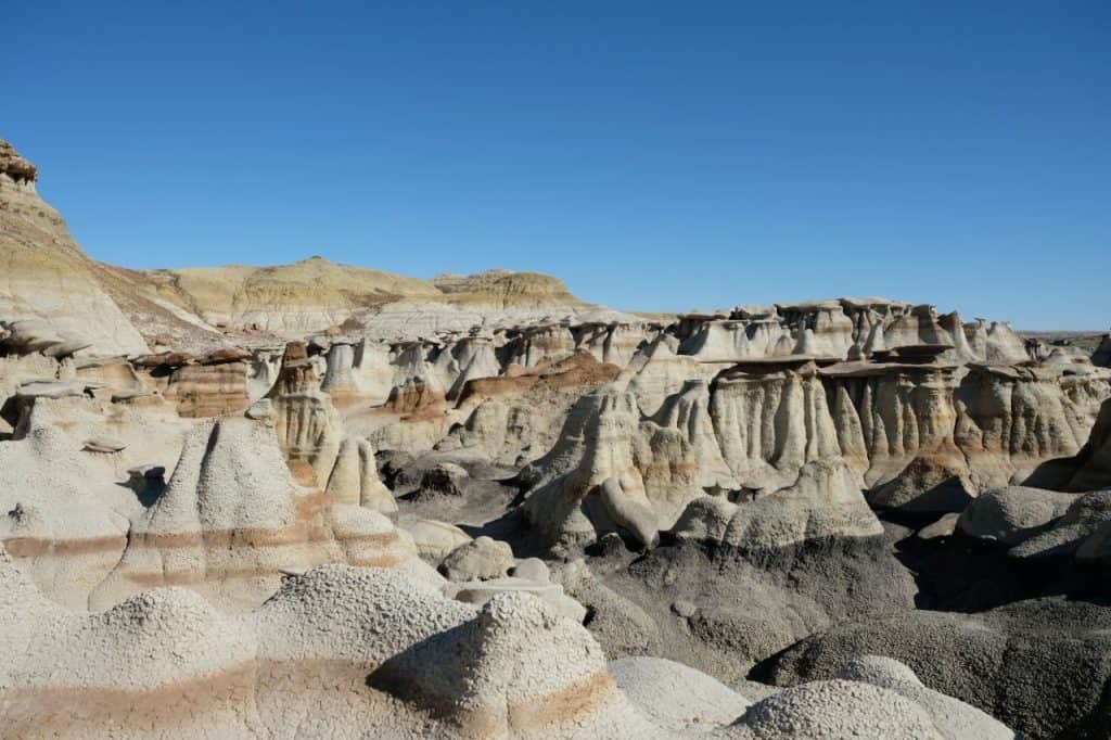
The Historic Railroad Trail is a 7.5 mile/12km circular hike that links the Lake Mead visitor center to the Hoover Dam; a trail which follows the old railway snaking through five tunnels, providing panoramic views over Lake Mead and culminating in the Hoover Dam.
Starting from Lake Mead’s visitor center, the car park provided has two eco-toilets (best to provide your own paper & eco-wipes) and approximately thirty places for a range of different sized vehicles. If you’re driving an RV, best to get there early before the spaces fill up.
The hike itself was declared a recreation trail in 2015 and is relatively flat & easy, perfect for hikers, strollers, runners and cyclists. You don’t need any specialist equipment but you will need water.
The hike is hot and largely uncovered with little shade and is shut between July and September because of the extreme temperatures in Nevada. Another point to remember is that there are no toilets along the trail, although there is an eco-toilet at gate five where the gates are locked at sunset.
Along the trail, easy to read information boards share the history of the construction of the dam, the flooding of Lake Mead & the developments of the track which ran between Boulder City and the Hoover Dam from 1931 to 1961. The track is definitely not off the beaten track and it’s fairly popular but it does give the most spectacular views over Lake Mead which glistens the same shade as the sky.
The last mile of the trail becomes Barron with little to see. This is because the lake is no longer visible but the graveyard provides some entertainment so make sure you stop & have a look. Of course, the highlight of this trail is when you first see the Hoover Dam. The sheer scale of this engineering is a beast and it’s situated across two time zones which adds to its charm.
Suggested by Emma from the blog Journey of a Nomadic Family

Mount Rose Trail, Sierra Nevadas, Nevada
Mount Rose Trail is a 10.7-mile loop trail located near Incline Village-Crystal Bay, Nevada. It is heavily trafficked and rated as difficult. Mt. Rose may be the second tallest peak in the Tahoe basin and one of the Lake Tahoe skyline marks. In spite of 2,300ft elevation gain, the hiking is a pleasant experience, although a challenging one.
The trail offers a number of activity options. It is best used from March until October. It features a waterfall and is especially pleasant in the fall. From the top summit of Mt. Rose, you will have great views of waterfalls, alpine lakes, and the great Lake Tahoe.
Pets, including dogs and horses, are allowed on the trail.
The Adirondack Park, New York
The Adirondack Park covers more than 6 million acres of New York State’s wilderness. The park is home to over 2,000 miles of hiking trails of all difficulties, making it the perfect destination for hikers at the beginning level all the way through to those who have mastered hiking skills.
The Adirondacks encompass much of Northeastern New York and due to them spanning such a great distance, getting there would depend entirely on the hike you were planning on doing. Most of them would be relative to one of the small towns/villages within the Adirondacks, such as Lake Placid, Old Forge, or Lake George.
Choosing a must do hike for this area is difficult, as the journey is fantastic and the views spectacular for each of them! For the beginning level hiker, Stewart’s Lodge is not to be missed. Stewart’s Ledge is located right outside Lake George, NY in Fort Ann. The hike is an easy one with very little elevation gain (272 ft.), but will provide you with stunning views of both Lake George and the surrounding mountains.
If you are an experienced hiker, one of the must do hikes is Mount Marcy. Mount Marcy is the highest elevation point in New York State and is quite the challenging hike, not for terrain, but rather for the distance. A hike to Mount Marcy can take on average 7 hours, but the views of the surrounding Adirondack High Peaks are well worth it when you reach the top.
Aside from hiking, the Adirondacks will keep every member of your family engaged and entertained with a couple of theme parks to choose from, including New York State’s largest waterpark in Old Forge, an Olympic training site in Lake Placid, a walk among the tree tops at the Wild Center in Tupper Lake, and plenty of water sports at every turn.
Suggested by: Melissa from the blog Navigation Junkie
Read this: The Best Adirondack hikes as per a local

Cold Spring Hike, Cornish Estate Trail Loop, New York
Cornish Estate Trail Loop is 5.1 miles long. Seventy years ago, at the time when the mountain was inhabited, it used to be a road used by local residents.
Hikers pass the several old stone ruins that give the trail a sense of mystery. Marked by blue disc blazes, the elevation is 1437 feet but it’s definitely worth it. When you reach the top, the panoramic view of Hudson River, a gurgling brook, the sky, and the distant New York skyline are magnificent.
You should visit it in the fall and enjoy the stunning beauty of the foliage turning into the fall colors.
You might also like: Where to find the best views of the NYC skyline for free

Silver Falls State Park in Oregon
A hike through the Silver Falls State Park in Oregon is an unforgettable experience. A trek of about 8 miles, you will see 10 waterfalls along the way, 4 of which you can walk behind. The fall foliage is amazing on the very old trees located there and for a truly magical experience, this is where to head.

Wildwood Trail, Forest Park, Oregon
Willwood Trail in Forest Park, Oregon is 30.2 miles long, which makes it America’s longest forested urban trail. It is open all year round, but fall may be an ideal time for hiking there because of the exuberant seasonal colors of foliage and wildflowers. This is a heavily trafficked trail which offers a number of activities.
From the south, it begins at the Vietnam Veterans Memorial in Washington Park and ends at Newberry Road northwest.
For your convenience, every quarter-mile there are blue, diamond-shaped blazes drawn onto trees about six feet from the ground to mark the trail, and mile markers about two feet above the blue diamond ones, to show the distance from the Vietnam Memorial trailhead.
The trail is divided into five parts. Part 1 leaves at Vietnam Memorial and stretches to Lower Macleay Park. Hikers need about 3 hours to walk the 6-mile distance and you should definitely take a map. The trail is well maintained and the invasive English ivy is kept under control. The moderate climate makes hiking through the gorgeous trees pleasant in the fall.
Hikers need another two and a half hours for the 6-mile long part 2 from Lower Macleay to Firelane 1. It is one of the most highly trafficked parts in Forest Park but worth it to walk among big leaf maple trees while birds serenade you.
For about 8 miles of part 3, Trillium Trail to Springville Road, you’d need about 3 hours. This section is lovelier and less populated, hidden from the city buzz, lightly traveled, filled with tranquility and solitude.
Part 4 from Springville Road to Germantown is about 6 miles long but will generally take only about 2 hours. This quick hike is very family-friendly.
For the very isolated part 5 of the trail, Germantown To Newberry, a five-and-a-half-mile section, plan on about 2 hours. This part is fairly popular with families with small children and older people who just want to take a leisurely stroll.
Hikers should always stay on the trail, observe posted rules for allowed trail uses, and be careful not to litter. Wildlife and watershed health in Forest Park should be carefully protected.
If you want your pet to keep you company, dogs are allowed to use this trail but must be kept on a leash.

Rickett’s Glen State Park, Pennsylvania
One of the best areas for hiking in the northeast is Rickett’s Glen State Park in Pennsylvania’s Pocono Mountains. It’s also one of the best day trips from Philadelphia and can be reached by car in about two hours from the city.
The popular state park is a stunning slice of nature with more than 24 waterfalls depending what time of year you visit. The ribbons of scenic trails allow you to trek around over 13,000 acres of land in three different counties. The trails vary in elevation and difficulty, so whether you’re looking for a challenging day hike, a multi-day trail experience or a kid-friendly trek – there’s something for everyone.
If you plan a trip to Rickett’s Glen, you’ll find the most brilliant waterfalls in the spring months when rain and snowmelt are most likely. Pack sturdy shoes in that period because the trails can be muddy, less packed and sometimes areas are uncleared in early spring.
While the water features of Rickett’s Glen make it extremely popular, swimming has been restricted in most of the waterfalls and their water holes. There are some areas of the park where swimming is still permitted at your own risk. The water is cold and refreshing, but pay attention to signs that are posted before you decide to go for a dip.
If you’re looking for a place to stay in the area, there are several popular campgrounds in and around Rickett’s Glen. One such place to stay is Rickett’s Glen Park Campground which has tent and RV sites plus cabins.
Suggested by Derek and Mike from the blog Robe Trotting
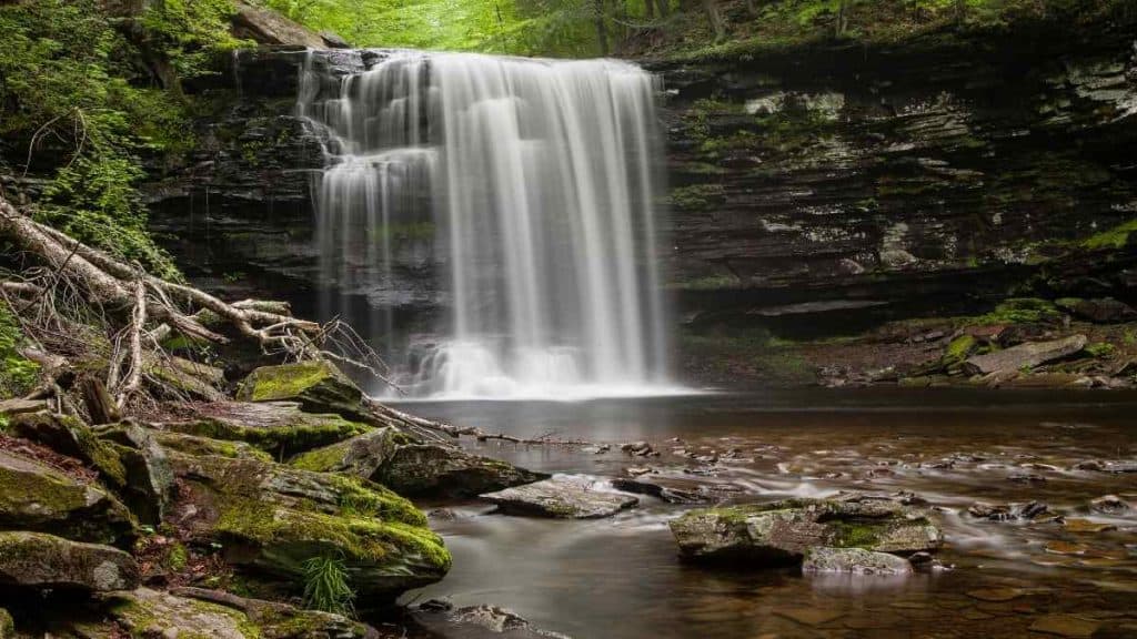
The Cathedral Spires trail in the Black Hills of South Dakota
The Cathedral Spires trail is one of the best, most unique hikes in the Black Hills of South Dakota. It’s about twenty minutes from Keystone, the perfect place to base yourself in the Black Hills, along the Needles Highway, one of the best scenic drives in the area.
This is a moderate hike, but it’s not terribly long, under two miles round-trip and only takes a couple of hours depending on how much you stop and how long you spend at the top. This is great for beginners and experienced hikers since it’s easy to follow but super unique.
The trail itself is a little muddy at the beginning when you’re going through the more woodsy part, but as you get closer to the top it becomes more light packed dirt. If you’re an experienced rock climber and want to do some climbing, you can do that here as well.
If you’re not, you can still see people climbing if you look at the spires on the right side of the trail on your way up. It’s a moderately trafficked trail in a popular area and there are tons of other awesome hikes nearby so you could spend all day here.
Sylvan Lake, Sunday Gulch, and Poets Table are three great options within a few miles of Cathedral Spires. Plus, it’s just a great driver to get there. This is also not far from Custer State Park, Wind Cave National Park, Mount Rushmore, and Spearfish Canyon making it a great overall hiking destination.
Suggested by Megan from the blog Red Around World

Big Bend National Park, Texas
Big Bend National Park is one of only two national parks in Texas. It rests along the bend of the Rio Grande River that forms the border of Mexico and West Texas. Despite being in the desert, it’s an excellent hiking destination.
This small park houses an entire mountain range within its borders and is the only national park that can boast of that. Some of the best hikes in Big Bend are here, in the Chisos Mountains.
Epic trails like The South Rim (which offers a panoramic view of Mexico), the Lost Mine and the Window Trail are all bucket list experiences. Of course, the desert and river all feature iconic Big Bend trails such as Elena Canyon and Mule Ears.
The hikes in Big Bend range in difficulty. Long trails like the South Rim are strenuous, however, there are plenty of family-friendly trails as well (like the short Hot Springs Trail which is great for swimming on hot summer days).
It’s hard to get to Big Bend due to the distance and there aren’t any large cities nearby. Terlingua is the closest town and has the best accommodation, a historic ghost town located just 15 minutes from the entry gates.
The closest airports are in Midland and El Paso, but it’s still a long drive from either to the park. Rent a car if flying in and prepare for an epic road trip.
Suggested by: Erin from Sol Salute

Wire pass Slot Canyon, Utah
Wire Pass Slot Canyon day hike is one of the best hiking trips in the USA! Forget the crowds and heavy entrance fee of Antelope Canyon and go to Wire Pass slot canyon instead.
Wire Pass slot canyon is one of the best hiking trips as it does not require technical gear, you can bring your dog and it costs just 6$ per person to enter.
To reach Wire Pass slot canyon you must first pray to the weather gods. The nearest big city is Kanab, Utah and from there you continue on Highway 89 before turning on the House Rock Valley Road.
This is a dirt road that is impassable in wet weather. Yet in dry weather, it is doable in a sedan. Continue on the dirt road for 8 miles until you reach the Wire pass slot canyon trailhead. This is the same place where people start their hike on the famous Wave hike!
From the trailhead it is a short 1-mile hike to the slot canyon. Wonderous orange rocks allude to the landscape that awaits you!
You can enter Wire Pass slot canyon at the entrance or go round the top into a lower section. The slot canyon is just beautiful. Be aware that there is an obstacle shortly after the entrance. Sometimes there is a ladder, sometimes there is not. If you don’t fancy tackling the obstacle you can follow the little stone cairns to the right of the entrance and go in that way.
Wonder as far along the slot canyon as you like. Wire Pass eventually leads into Buckskin Gulch, said to be the longest slot canyon in the world! Then when you are ready head back the way you came.
Wire Pass is an epic hiking trip in the USA!
Suggested by: Anna from the blog My Travel Scrapbook

Zion National Park, Utah
Zion National Park in southwest Utah is a great destination for hiking thanks to a variety of scenic trails that are easily accessed from the heart of the park. There’s a trail that’s suitable for every type of hiker from the casual sightseer to the adventurous explorer.
Some of the park’s most famous trails are strenuous hikes that take between 4 to 8 hours to complete. For those that are up for a challenge and not afraid of steep drop-offs, don’t miss Angels Landing Trail and Observation Point Trail. Both hikes have a large elevation gain but the views from the end of the trails are among the best in the park.
For a more moderate hike, must-do trails include the Watchman Trail and Canyon Overlook Trail. Both these hikes end at viewpoints looking out onto Zion Canyon.
Some family-friendly nature walks in the park include Pa’rus Trail and the Riverside Walk Trail. These easy trails follow along the Virgin River and are paved so are wheelchair accessible (though some assistance may be needed).
Zion National Park can be accessed by car and the closest international airport is in Las Vegas, Nevada. The nearest regional airport is in St. George, Utah. A good selection of accommodations can be found in the town of Springdale, which is located immediately outside the boundary of the park. The next closest city would be St. George, roughly an hour drive away from the park.
Suggested by Rhonda from the blog Travel Yes Please

Healdville Trail, Okemo State Forest, Vermont
Healdville Trail in Okemo State Forest will give you the archetypal experience of a fall foliage hike. It is a 5.6 mile lightly trafficked out and back trail, rated as moderate. It features lovely wildflowers and, while heading to the top you’ll see beautiful evergreens, and along a 3-mile trail there’s a charming, relaxing stream and hardwood glades. At the top, there is a watchtower with 360-degree breathtaking views of the surrounding mountain ranges. Take your dog with you but keep it on a leash.
White Oak Canyon Trail, Shenandoah National Park, Virginia
Shenandoah National Park on the east coast holds some of the best views in the fall. It offers everything a hiker could want, from short trails to longer ones, where you will need your backpack and camping gear. Definitely consider taking the White Oak Canyon Trail. This day-long trek is a nine-and-a-half-mile and though challenging, it’s also peaceful and leads you passed some amazing waterfalls. It is a moderately trafficked out back trail, rated as difficult, but well worth the effort.
Another Favorite: A fun road trip from Tennessee to Virginia

Mt. Baker in the North Cascades, Washington
With one way in and one way out, Mt. Baker is one of those hidden gems in the North Cascades of Washington. Ok, it still gets pretty busy, but not like the trails near Seattle.
If you’re looking to extend your hiking trip with an overnight stay, I’d wholeheartedly suggest staying in Bellingham. With its slightly hippy vibe, you’ll find farmers’ markets, specialized cider bars, and even a meadery with mead on tap! It takes around 1.5 hours to get to Mt. Baker from Bellingham, so you’ve got to be ready for an early start.
Because the Mt. Baker Wilderness area is pretty high up, it takes a while to clear after winter ends, so the earliest you can hike the area is usually around the end of June.
When you head up towards Mt. Baker, drive all the way up the road to Artist Point and find a parking spot. Try not to get too distracted by the views just yet. You’ll have plenty of time to marvel when you’re on the trails.
From Artist Point, you have 3 options depending on your hiking level.
- Take a short walk out to Huntoon Point along the 1.2-mile gravel trail. You’ll find some of the best views of the area, for minimal effort!
- If you’re a little more spritely, you can head up onto the Table Mountain trail, which is the highest point you can get to in the area. It’s only a 2.7-mile round trip but beware of the elevation gain.
- The last option is for more seasoned hikers. A hard 6.5-mile loop around the Chain Lakes Trail includes a lot of stair climbing towards the end (or the start depending on the direction you complete the trail). This trail will give you a little more variety than the other two and requires a full day to complete.
Suggested by: Nick from the blog Illness To Ultra

Ice Age National Scenic Trail, Wisconsin
The Trail stretches completely within Wisconsin. It is one of only eleven National Scenic Trails. There, you will stroll through intact wilderness, farmlands, and public parks. The path is more than just a hike – it is a place to relax both physically and mentally, in historic natural surroundings. It is a hundreds-of-miles long hike but, for the fall weather, the best section for a comfortable day trip is the La Budde Creek Section near Elkhart Lake.
The hike is used by more than one million people each year for hiking, snowshoeing and backpacking.
Grand Teton National Park, Wyoming
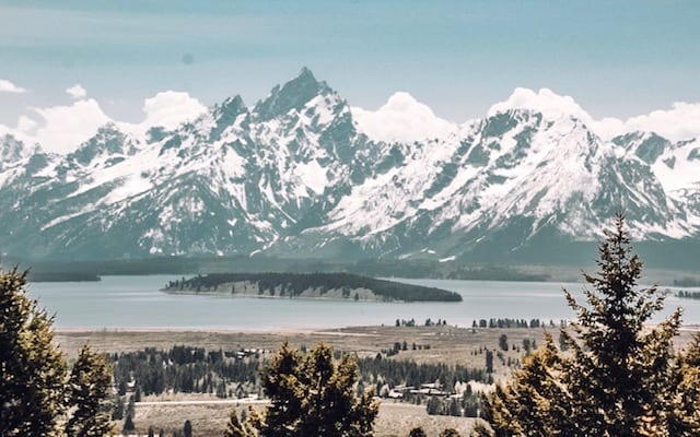
Grand Teton National Park is an absolutely stunning place to visit throughout the year, however, in Fall this place truly shines. All of the hiking, the wildlife, and the stunning lake & mountain views in the park make this a must-visit destination.
To get to Grand Teton, you’ll have to fly into Jackson, Wyoming, unless of course you are also visiting Yellowstone and want to take a side-trip to Grand Teton for some hiking and adventure. Drive north from Jackson just a few miles and you’ll see some of the most beautiful mountains in the Rockies, the tallest of which is Grand Teton.
In the park, you’ll find some of the most epic day hiking a person can find. Grand View Point, Two Ocean, and Emma Matilda Lake makes for an awesome 3-site hiking day. Perhaps the only day of hiking in the park that beats this one is a morning at String Lake followed by the Bradley Lake and Taggart Lake loop.
These hikes are not incredibly strenuous, but at the same time are not for beginners. The hikes are a few miles and some involve ascents of 1,000 feet.
The Garnet Canyon and Death Canyon hikes are also great, and get you deeper into the mountains than the other hikes mentioned. While you are on these hikes, keep your eyes peeled for the wildlife that makes Grand Teton special. Herds of deer and elk are everywhere, as well as the opportunity to see black bears feasting on berry bushes. If you are looking for an easier hike, or destinations you can drive to, then head to Signal Mountain, Jenny Lake, and Jackson Lake.
While visiting Grand Teton, you’ll be driving and stumble upon an epic viewpoint or a still lake that reflects the mountains beyond. Stop at these wonderful sites, enjoy all the natural beauty, hike your butt off, and above all have fun!
Suggested by: Zach and Julie from the blog Ruhls of the Road
We’ve only just begun….
There really is no limit to the number of wonderful hiking opportunities in the States. Those mentioned here are just a few of the recommended places for hiking in the Fall, but there are many more, including The Gothics in Adirondacks, New York, the High Pass Loop in North Cascades, Washington, and the La Sal Mountains in Utah, just to name a few. And all are places that should be visited since they provide memorable hiking experiences.
When you want to be surrounded by an abundance of colors, amazing views and peaceful solitude, then there’s nothing like a good hike in the US!
Enjoyed reading? Save it for later on Pinterest!